Hillwalking
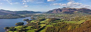
Hillwalking usually refers to walking in mountainous areas in the UK particularly in Northern England. Walks or hikes undertaken in upland country, moorland, and mountains, especially when they include climbing a summit are sometimes described as hillwalking or fellwalking in the United Kingdom. Though hillwalking can entail scrambling to reach a mountain summit, it is not mountaineering. Fellwalking is a word used specifically to refer to hill or mountain walking in Northern England, including the Lake District, Lancashire, especially the Forest of Bowland, and the Yorkshire Dales, where fell is a dialect word for high, uncultivated land.
Popular locations
Popular locations for hillwalking include the Lake District, the Peak District, the Yorkshire Dales, Snowdonia, the Brecon Beacons and Black Mountains, Wales, Dartmoor and the Scottish Highlands. The mountains in Britain are modest in height, with Ben Nevis at 4409ft the highest, but the unpredictably wide range of weather conditions, and often difficult terrain, can make walking in many areas challenging. Peak bagging provides a focus for the activities of many hillwalkers. The first of the many hill lists in the British Isles compiled for this purpose was the Munros – mountains in Scotland over 3000ft – which remains one of the most popular.
The United Kingdom offers a wide variety of ascents, from gentle rolling lowland hills to some very exposed routes in the moorlands and mountains. The term climbing is used for the activity of tackling the more technically difficult ways of getting up hills involving rock climbing while hillwalking refers to relatively easier routes.
However, many hillwalkers become proficient in scrambling, an activity involving use of the hands for extra support on the crags. It is an ambiguous term that lies somewhere between walking and rock climbing, and many easy climbs are sometimes referred to as difficult scrambles. A distinction can be made by defining any ascent as a climb, when hands are used to hold body weight, rather than just for balance. While much of the enjoyment of scrambling depends on the freedom from technical apparatus, unroped scrambling in exposed situations is potentially one of the most dangerous of mountaineering activities, and most guidebooks advise carrying a rope, especially on harder scrambles, which may be used for security on exposed sections, to assist less confident members of the party, or to facilitate retreat in case of difficulty. Scramblers need to know their limits and to turn back before getting into difficulties. Many easy scrambles in good weather become serious climbs if the weather deteriorates. Black ice or Glaze ice is a particular problem in cold weather, and mist or fog can disorientate scramblers very quickly.
Many of the world's mountaintops may be reached by walking or scrambling up their least steep side. In Great Britain ridge routes which involve some scrambling are especially popular, including Crib Goch on Snowdon, the north ridge of Tryfan, Striding Edge on Helvellyn and Sharp Edge on Blencathra in the Lake District, as well as numerous routes in Scotland such as the Aonach Eagach ridge in Glen Coe. Many such routes include a "bad step" where the scrambling suddenly becomes much more serious.
In Britain, the term "mountaineering" tends to be reserved for technical climbing on mountains, or for serious domestic hillwalking, especially in winter, with additional equipment such as ice axe and crampons, or for routes requiring rock-climbing skills and a rope, such as the traverse of the Cuillin ridge, on the Scottish island of Skye. The British Mountaineering Council provides more information on this topic.
Navigation and map-reading are essential hillwalking skills on high ground and mountains, due to the variability of British and Irish weather and the risk of rain, low cloud, fog or the onset of darkness. In some areas it is common for there to be no waymarked path to follow. In most areas hiking boots or walking boots are essential along with weatherproof clothing, spare warm clothes, and in mountainous areas a bivvy bag or bothy bag in case an accident forces a prolonged, and possibly overnight halt. Other important items carried by hillwalkers are: food and water, an emergency whistle, torch/flashlight (and spare batteries), and a first aid kit. And, where reception permits, a fully charged mobile phone is recommended. Hillwalkers are also advised to let someone know their route and estimated time of return or arrival.
Guidebooks
W A Poucher (1891–1988) wrote several hillwalking guide books, in the 1960s, which describe, in detail, the various routes up specific mountains, along with the precautions needed and other practical information useful to walkers. The guides cover Wales, Peak District, Scotland, Isle of Skye and the Lake District. Even more detailed guides were written by Alfred Wainwright (1907–1991) but these are mainly restricted to the Lake District and environs. His main series of seven books was first published between 1955 and 1966. Both authors describe the major paths, their starting points and the peaks where they end, with important landmarks along each route. Neither are entirely comprehensive. More recently Mark Richards has written numerous walking guides, especially for the Lake District, for the publisher Cicerone, who are now the leading publisher of walking guides in the UK. The Scottish Mountaineering Club are, through the experience and knowledge of their members, the largest publishers of guidebooks to climbing and walking in Scotland.
